BOWEN360 Solutions · Your Mission Brief
GASPAR GRANDE
Drone Mission & Aerial Survey Plan
Aerial Videography · Mapping · Topographic Data · 3D Site Intelligence

LocationGaspar Grande
Flight Team2 Pilots
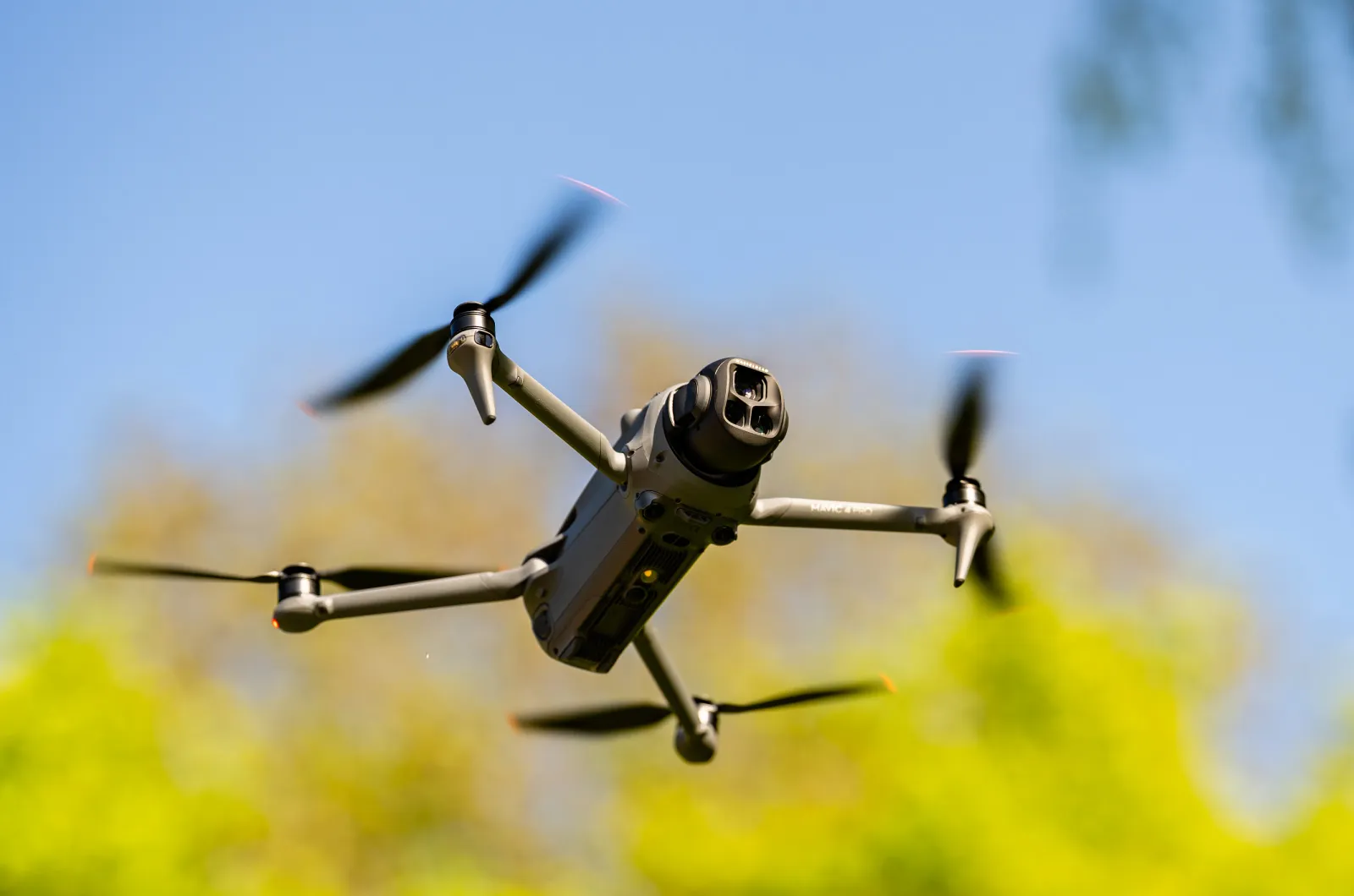
Visual AircraftDJI Mavic 4 Pro
Survey PlatformDJI Mavic 3 Enterprise
Mission Duration6.5 Hours Total
Prepared for: [CLIENT NAME]Prepared by: BOWEN360 SolutionsDate: September 2026
Document Purpose
Your mission and deliverables plan
This brief sets out the scope of your Gaspar Grande aerial assignment, how we will carry it out and exactly what you will receive. We will confirm final flight parameters, survey extents and regulatory approvals with you before mobilization.
01 · About Us
Aerial intelligence for your planning, documentation and decisions
We are BOWEN360 Solutions. We provide professional drone-based aerial surveying, inspection, mapping, site documentation and visual media. We combine experienced flight operations with modern aerial imaging and data processing to turn your site conditions into visual and spatial information you can use.
Aerial Surveying
Structured aerial capture for mapping, elevation analysis, surface models and project planning.
Aerial Videography
Professional high-resolution footage for your stakeholder presentations, documentation and communications.
3D Site Intelligence
Digital site models that provide an intuitive understanding of terrain, structures and site relationships.
Project Documentation
Repeatable visual records that support progress monitoring, reporting and future comparison.
Data Processing
Photogrammetric processing, mapping outputs and presentation-ready project datasets.
Mission Planning
Site-specific operational planning focused on coverage, safety, efficiency and data quality.
Our approach for you: a coordinated two-pilot operation using separate aircraft optimized for survey capture and cinematic visual documentation — giving you a reusable digital record of your site while avoiding unnecessary repeat mobilization.
02 · Project Overview
Your Gaspar Grande aerial survey and videography assignment
Your mission combines professional aerial videography with systematic aerial mapping of your agreed project area, giving you both a compelling visual record and a structured spatial dataset — all captured in a single 6.5-hour mission.
Primary Objective
- Capture a current aerial record of your agreed mission area.
- Produce the spatial data you need for project planning and review.
- Provide you with professional video and photography for your communications.
Mission Success Criteria
- Complete your agreed coverage safely and efficiently within the 6.5-hour mission.
- Achieve sufficient image overlap and image quality for processing.
- Deliver clearly organized, presentation-ready outputs to you.
03 · Mission Area
Gaspar Grande — your operational area reference
The image you supplied establishes the working project context. We will confirm the final survey boundary, launch points and operational zones with you during mission planning.
Project Area
The area you define for us to document and survey.
Survey Coverage
Systematic mapping passes designed around the confirmed boundary and terrain.
Video Coverage
Key approaches, coastline, terrain and project context selected for visual storytelling.
Flight Operations
Launch/recovery and pilot positions selected after site access and airspace review.
The map you receive stays clean and focused on your deliverable coverage. Detailed launch points, hazards, emergency landing options and pilot sectors remain part of our internal operational mission plan.
04 · Applications
How this mission supports you
VisualAerial Videography
High-resolution footage showing the overall location, coastline, terrain, access and key project features for presentations and documentation.
VisualAerial Photography
High-resolution nadir and oblique imagery providing a permanent visual record of current site conditions.
MappingOrthomosaic Mapping
A single high-resolution overhead map assembled from systematic aerial imagery for planning, review and measurement.
TerrainTopographic Data
Elevation and visible-surface information supporting terrain review, slope analysis, planning and technical discussions.
3D3D Site Modelling
A digital three-dimensional representation of visible terrain, buildings and site features for intuitive project visualization.
TerrainContour Mapping
Contour information derived from validated elevation/surface data to communicate changes in elevation across the mission area.
05 · Drone Data Explained
One coordinated mission. Multiple assets for you.
We won’t overwhelm you with technical process. Here are the project assets we can produce for you from your mission dataset.
Orthomosaic Map
High-resolution, geometrically corrected overhead imagery suitable for visual review, reference, measurement and planning.
3D Textured Model
Three-dimensional visual model of the site for project review, presentations and spatial understanding.
Digital Surface Model
Elevation model representing the visible surface, including ground, structures and vegetation captured by the survey.
Contour Data
Contour lines generated from validated elevation/surface data at an interval appropriate to the achieved dataset.
Point Cloud
Dense 3D point dataset used as a foundation for measurements, modelling and technical workflows.
Aerial Media
Professionally captured still photography and high-resolution video for documentation and stakeholder communication.
Terrain note: Photogrammetric elevation products represent surfaces visible to the camera. Dense vegetation can obscure bare ground; if you need true bare-earth terrain beneath canopy, we will advise on supplementary ground survey or LiDAR.
06 · Aircraft & Mission Team
Two pilots, two specialized flight roles, one coordinated mission
Pilot 01 · Survey & Mapping
DJI Mavic 3 Enterprise
Primary roleSystematic mapping
Main camera4/3 CMOS · 20 MP
ShutterMechanical
PositioningRTK-ready workflow
Published max flight timeUp to 45 min
Pilot 02 · Visual Documentation
DJI Mavic 4 Pro
Primary roleVideography & stills
Main camera4/3 CMOS · 100 MP output
VideoUp to 6K / 60fps HDR
Camera systemTriple-camera
Published max flight timeUp to 51 min
Flight Lead
Coordinates mission sequence, checks, your priorities and go/no-go decisions.
Survey Capture
Executes structured mapping flights, verifies coverage and confirms data completeness.
Visual Capture
Records cinematic video, contextual stills and agreed project viewpoints.
Field QA
Both pilots review imagery, storage, battery status, coverage and any required re-flight.
07 · Flight & Data Acquisition Strategy
Capture designed around coverage, terrain and deliverables
Survey Grid
Controlled mapping passes with suitable image overlap for photogrammetric processing.
Terrain / Elevation
Flight height and capture strategy adjusted to terrain, obstacles and required ground detail.
Oblique Capture
Supplementary angled imagery where required to strengthen 3D reconstruction of structures and complex terrain.
Video Routes
Pre-planned cinematic routes covering coastline, approaches, key features and establishing views.
Positioning
GNSS throughout; RTK and/or ground control incorporated where included in the final survey methodology.
Field Verification
We check coverage and image quality on site so any gaps are addressed before we leave.
01Site / airspace confirmation
02Survey acquisition
03Supplementary imagery
04Visual media capture
05Field QA
08 · Mission Execution Plan
From pre-flight planning through handover to you
Phase A — Pre-Mission
- Confirm your final boundary and priority areas with you.
- Review current airspace and approvals.
- Confirm site access, launch/recovery options and logistics.
- Review weather and go/no-go criteria.
- Prepare aircraft, batteries, memory and backup equipment.
Phase B — Field Operations · 6.5-Hour Mission
- Conduct on-site safety and operational briefing.
- Establish controlled launch/recovery areas.
- Execute survey and visual-media programme.
- Monitor weather, wind, airspace and battery status.
- Complete field quality checks and re-fly gaps if required.
Phase C — Processing
- Secure and duplicate field data.
- Process mapping imagery and reconstruct spatial dataset.
- Perform quality checks and validate outputs.
- Edit and organize photography/video as agreed.
Phase D — Delivery to You
- Package files by deliverable and format.
- Provide you with ready-to-use maps, media and technical outputs.
- Walk you through the handover and review.
- Archive agreed project data for the defined retention period.
Weather contingency: Gaspar Grande is a coastal/island environment. Wind, precipitation, visibility and salt spray can affect safe flight and image quality. For safety and data quality, we retain authority to pause or reschedule when conditions are unsuitable, and will agree a new date with you.
09 · Safety & Operational Controls
Commercial operations planned around compliance and site-specific risk
Regulatory Review
Confirm aircraft/operator requirements and applicable commercial UAS approvals before operation.
Airspace Check
Review current TTCAA no-fly-zone information, notices and temporary restrictions.
Site Control
Establish safe launch/recovery areas and separation from uninvolved persons and property.
Operational Awareness
Maintain adequate situational awareness and operate within applicable limitations.
Weather Limits
Use conservative wind, precipitation and visibility limits appropriate to aircraft and site.
Emergency Plan
Define lost-link, low-battery, forced-landing and emergency response procedures before flight.
10 · Data Processing & Quality Control
From raw imagery to your organized deliverables
01Data IngestOrganize and back up field media.
02PhotogrammetryReconstruct site and mapping products.
03Geometry CheckReview alignment, surface and reconstruction quality.
04Position CheckReview RTK/GCP/check-point results where included.
05Delivery QAExport, name and package agreed files.
Accuracy & suitability: we don’t make blanket accuracy claims before the final control methodology and site conditions are confirmed. Your drone-derived mapping is intended for the agreed project purpose and does not establish legal property boundaries unless you separately commission a licensed cadastral/land-survey scope.
11 · Project Deliverables
What you will receive
| Deliverable | Package | Format | Value to You |
|---|
| High-resolution aerial photographs | Included · Video & Production | JPG / selected RAW | Current conditions and site context |
| Professional aerial video | Included · Video & Production | 4K/6K source + edited MP4 | Presentation, documentation and communications |
| Orthomosaic map | Included · Mapping | GeoTIFF + presentation PDF/JPG | High-resolution overhead site map |
| 3D textured model | Optional · quoted on request | Viewer/export format as agreed | Interactive project visualization |
| Point cloud | Optional · quoted on request | LAS / LAZ or compatible | 3D analysis and downstream workflows |
| Digital surface model (DSM) | Included · Mapping | GeoTIFF / compatible raster | Terrain/surface analysis |
| Contour dataset | Included · Mapping | DXF / SHP / PDF as agreed | Terrain and elevation interpretation |
| Survey summary / metadata | Included · Mapping | PDF | Methodology, coverage and deliverables record |
12 · Schedule, Assumptions & What We Need From You
Planning basis for your assignment
Indicative Project Sequence
- You confirm scope and mission boundary.
- We complete regulatory and operational planning.
- We confirm your mission date within a suitable weather window.
- We complete field capture — 6.5 hours total mission duration.
- We complete data processing and media post-production.
- We deliver your package and review it with you.
What We Need From You
- Your final project boundary / areas of interest.
- Your site contact and access arrangements.
- Any restricted, sensitive or priority areas.
- Your required formats / coordinate system, if any.
- Your video shot priorities or branding requirements.
- Your delivery deadline and stakeholder requirements.
Your mission timing is subject to suitable weather, safe site conditions and required approvals. If marine transport, site access, accommodation or special logistics are needed, we will identify and price these with you separately.
13 · Your Investment
Your project investment
Your quotation covers two packages, both captured during one coordinated 6.5-hour mission.
Aerial Video Recording & ProductionMavic 4 Pro aerial video and photography capture, editing and post-production$4,500.00
Aerial MappingOrthomosaic, Digital Surface Model (DSM), Contours + Processing$4,800.00
Total Project InvestmentTotal mission duration: 6.5 hours$9,300.00
Optional deliverables (3D textured model, point cloud) and any marine transport, site access or special logistics are not included above and can be quoted for you on request.
 Kendall L BowenTeam PrincipalBOWEN360 Solutions